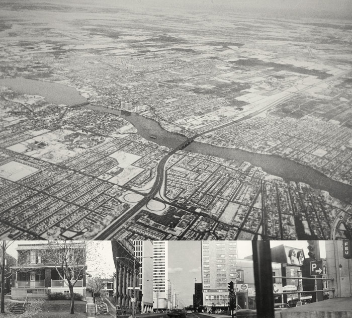
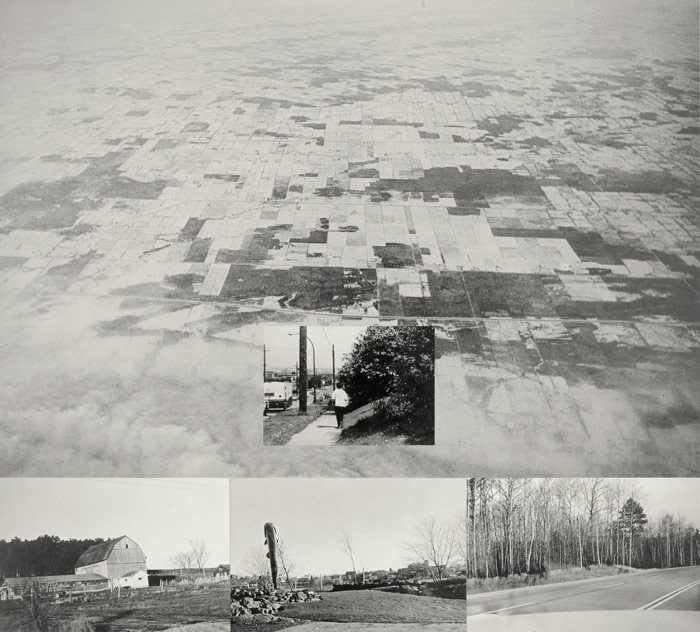
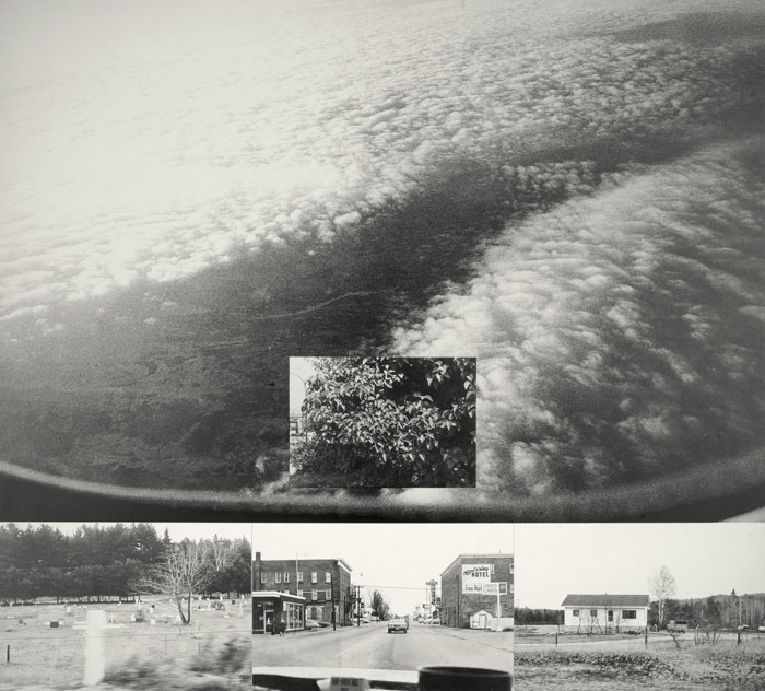
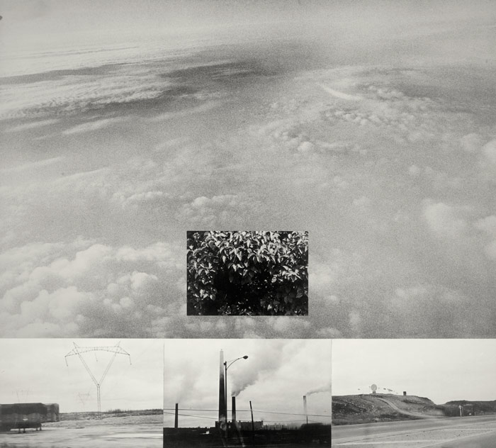
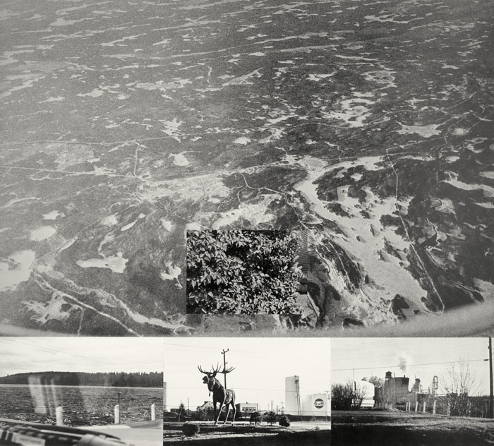
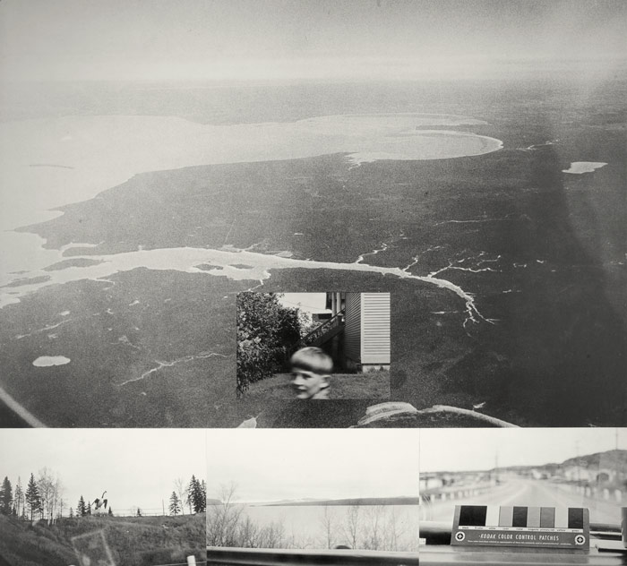
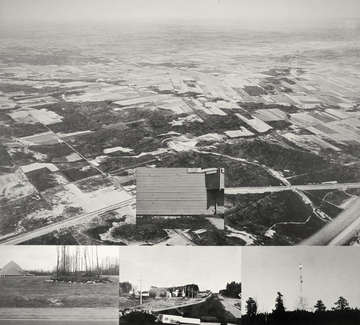
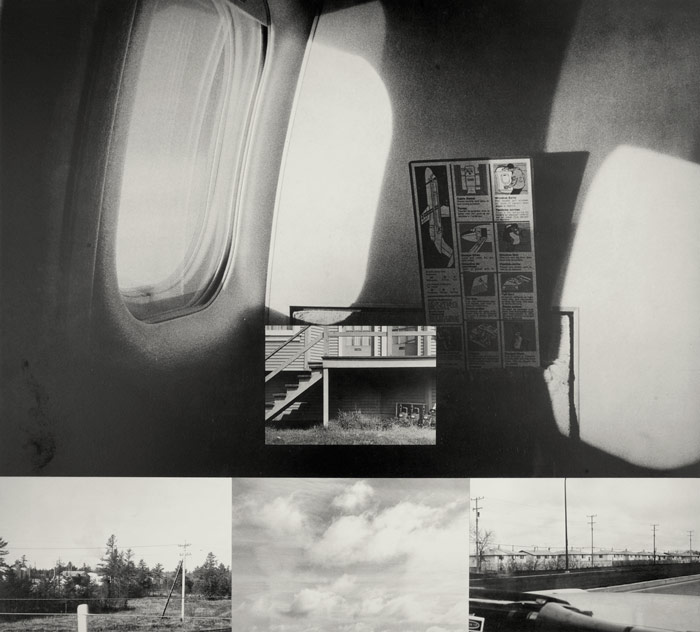
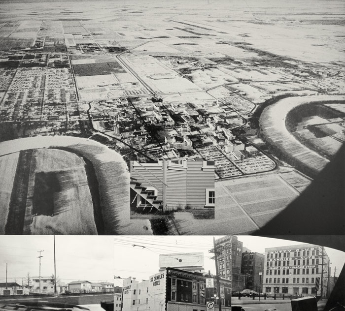
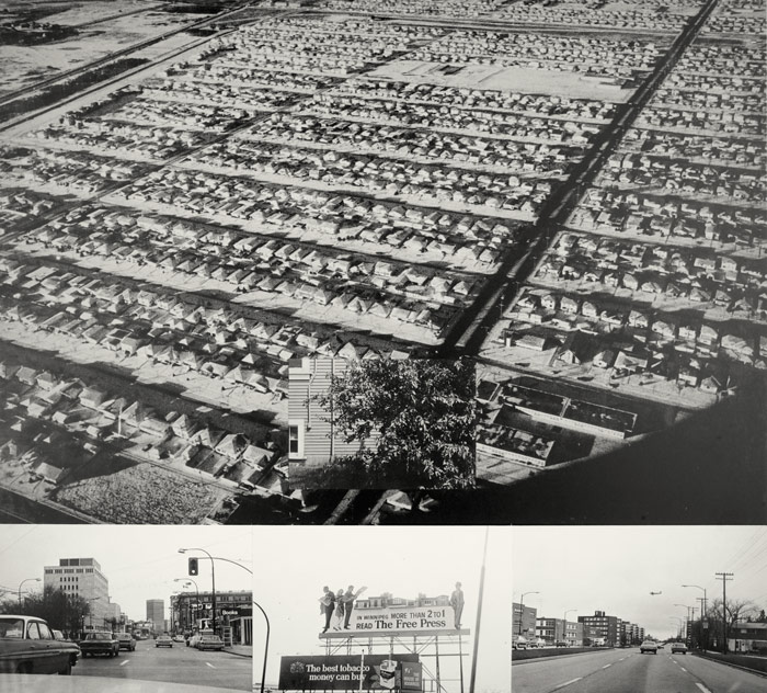
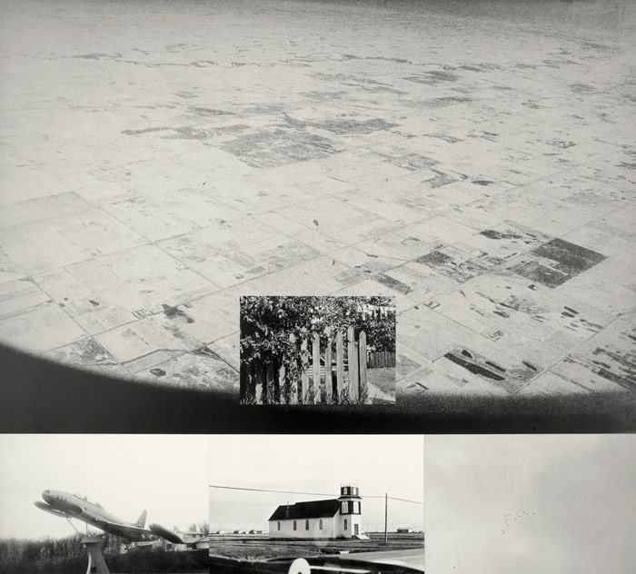
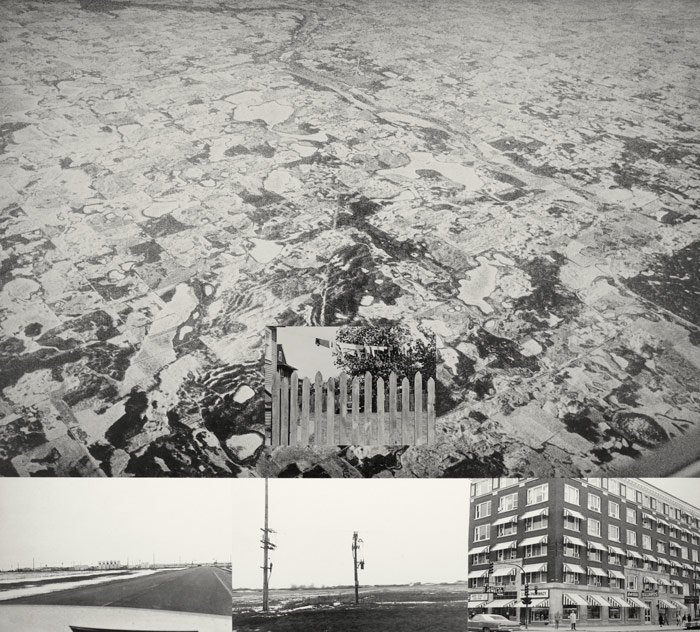
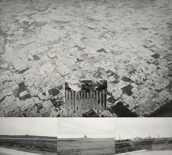
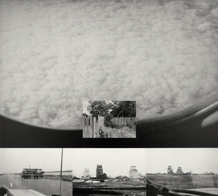
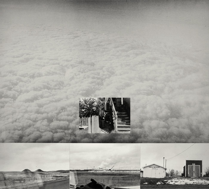
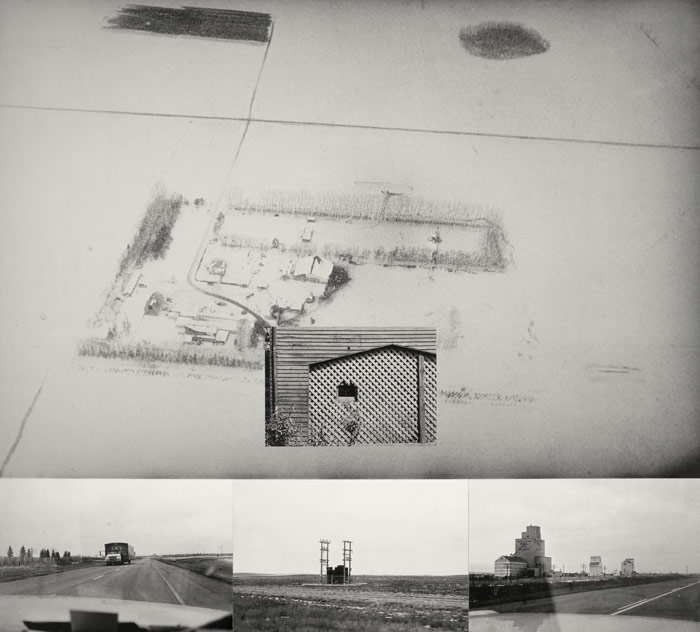
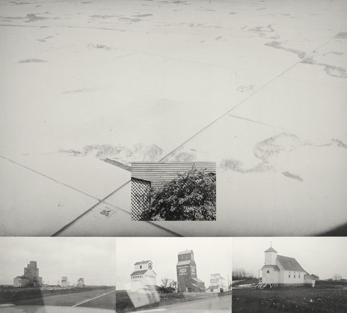
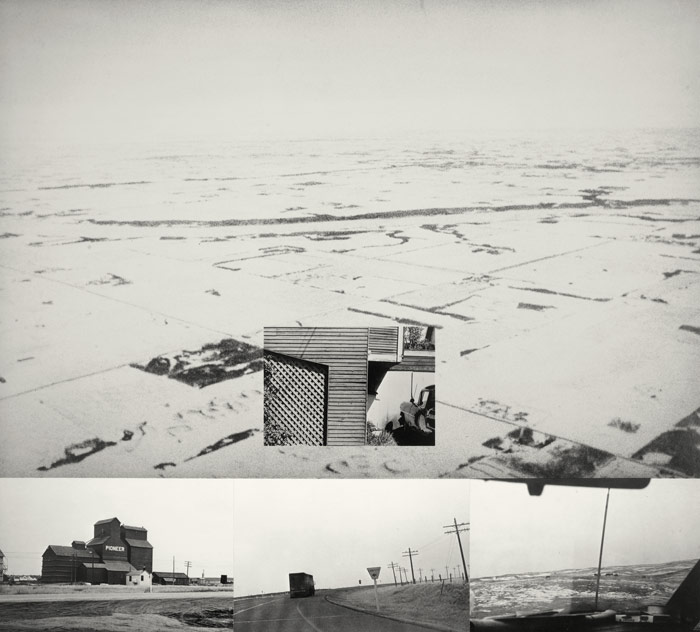
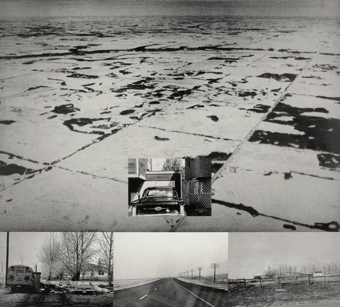
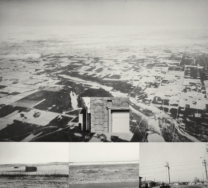
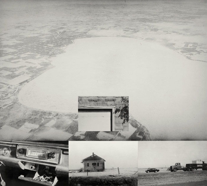
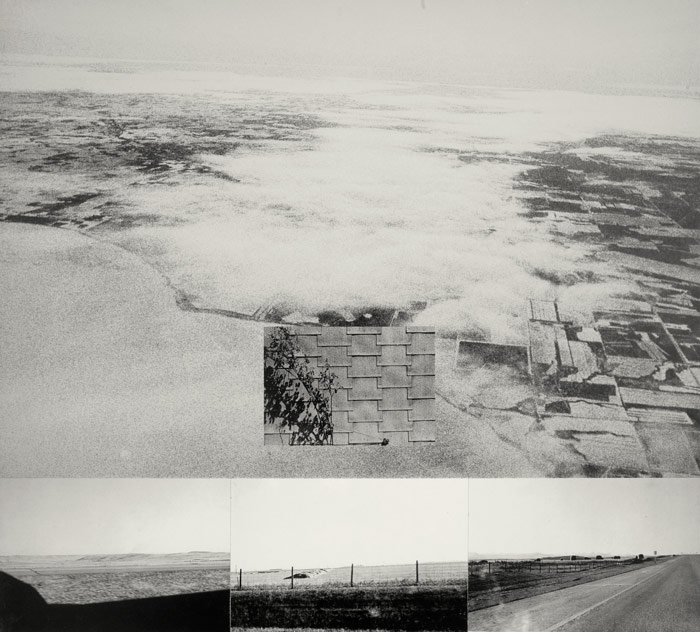
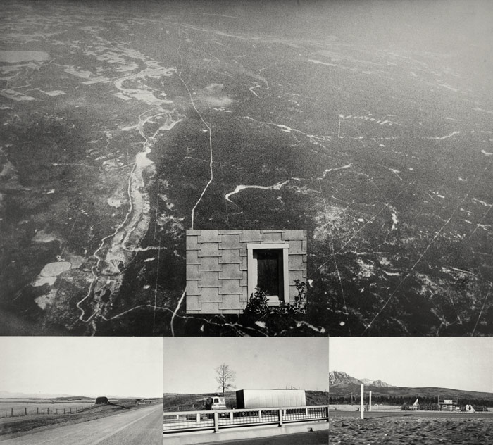
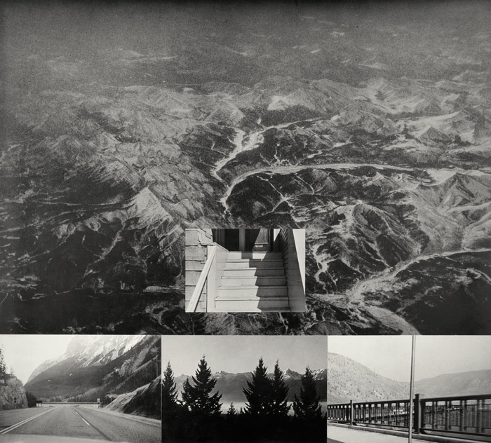
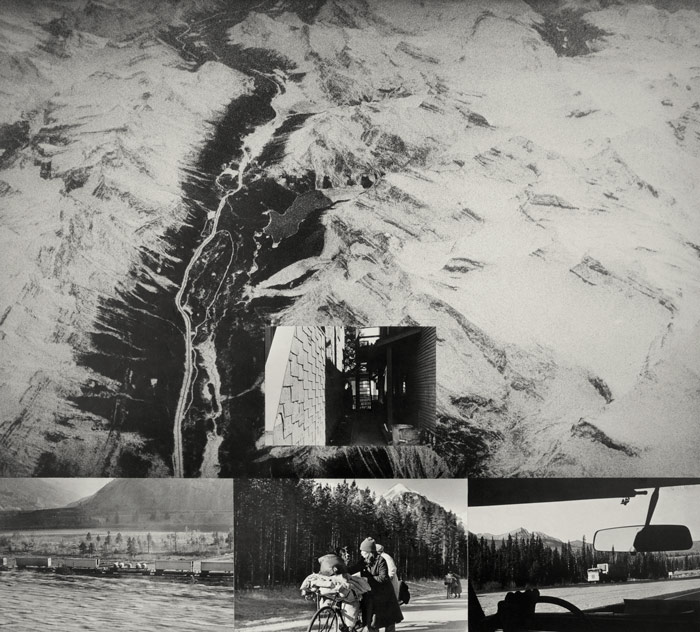
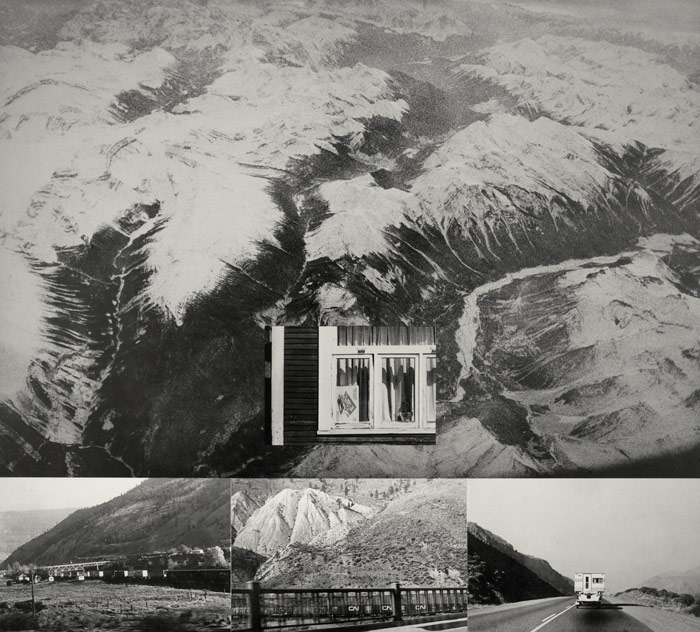
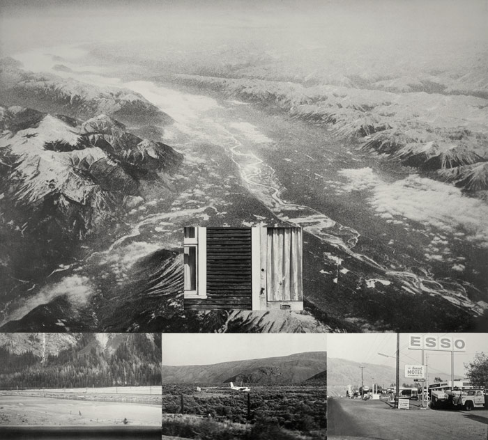
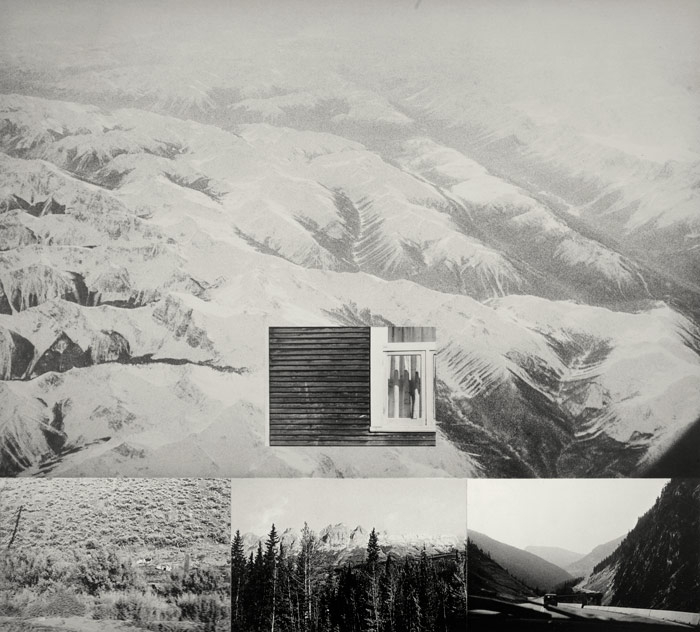
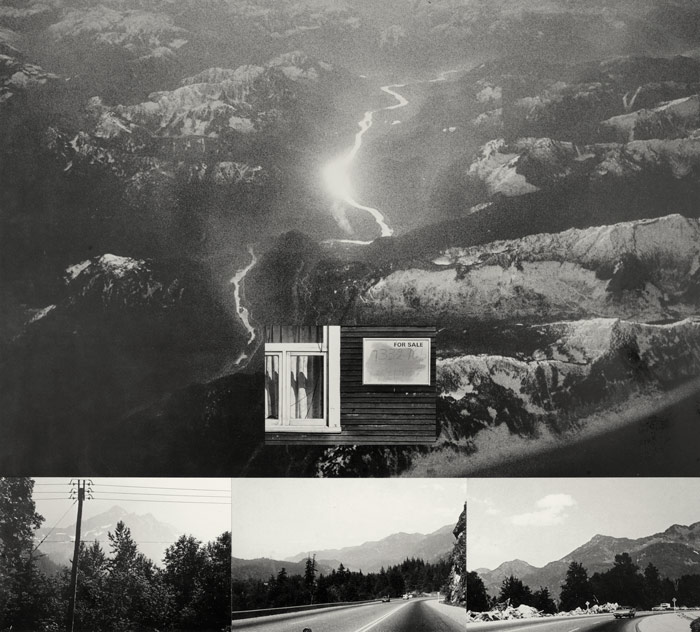
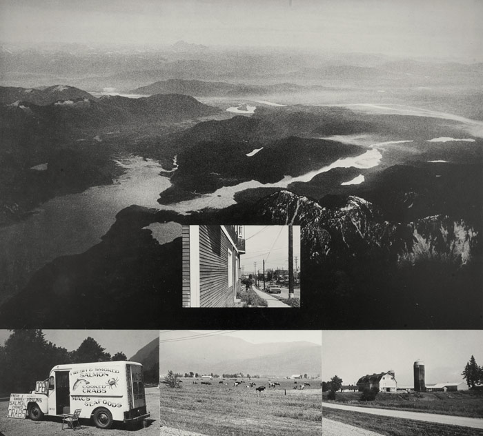
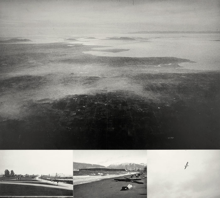
On a flight from Montreal to Vancouver Michael de Courcy took 36 aerial photographs of the ground 30,000 feet below.
Later, he travelled the same journey by car and took 108 photographs from the Trans-Canada Highway, He also walked from end to end of a short city block (the street where he lived at the time) and took 34 photos.
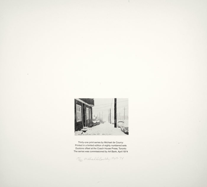
The photos have been assembled into a 36 page notebook entitled Cross Canada. On each page the photographs have been printed as a collage to present three different viewpoints simultaneously. Each page gives a detailed account of a specific location through an aerial view and three ground level shots. The single photograph of the Vancouver street forms, as de Courcy says, "a bridge between the two extremes of perception, from the general to the specific." In this respect, each page is somewhat like a travel brochure. In both, the intended destination is implicit. In de Courcy's book, the trajectory is one of "going home".
— from BORDERLINES IN ART AND EXPERIENCE by Joe Bobolai artscanada magazine, On Maps and Mapping Issue, Spring,1974— Issue Number 188/189