 |
 |
| |
| |
| |
| |
| |
| |
| |
| - Woodlands Timeline - Building Floorplan - "From the Clipping File" - "Third Reading" - "For the Record" - Video |
| |
| |
| |
| |


| Book 1 | Book 2 | Book 3 |
Click Here to see the installation.
contents:
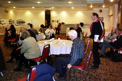
colour photographs and transcribed audiotapes of public workshops where British Columbia Buildings Corporation bureaucrats and their architects and planners (government team) met with community members (people) to debate the rezoning and re-development of the Woodlands site
january - february, 2002
continuation of transcript of dialogue from workshop # 4 - woodlands open space /greenways / circulation / utilities
wednesday january 30 2002
royal towers hotel
new westminster bc
 |
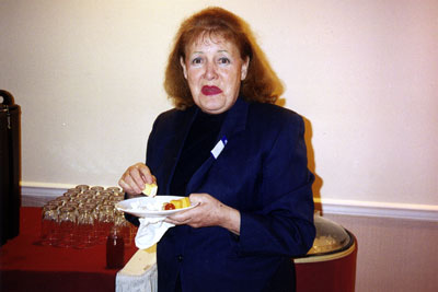
| new westminster resident, business owner and activist for the woodlands site transition- 2002 |
people
that could be established pretty quickly as soon as somebody determines how much housing youre building on the site
government team
yes weve known for awhile the relative scale of the number of units were talking about
people
and what exactly is that
government team
its going back and forth but its anywhere between - you could be looking at 1100 to 1400 residential units - we
dont know yet how many of those could be units with families with children living in them - but thats where it gets
really iffy - but the school board people take that and they can sort of see right away
people
so youre talking about 8% of the residents being children
government team
it really depends - if youre talking about seniors ----
people
so you have to average this all out
government team
03-14-35 - yeah but the school board does this - its a continual back and forth - there are a mix of units - some
of them seniors - they will take that and work it all out with regards to children
government team
affordable housing has been discussed as a part of that - we dont know the mix - part of that that relates to what
happens at bc housing - how many units and where they want to see them so ----
people
so at a minimum there would be 3000 people on a daily basis based on that principle
government team
its a range right - and thats probably not an unfair range - it really depends on the mix - how much of it is going
to be smaller apartments - how much of it is going to be seniors devoted - how much of it is going ----
people
everyone will have a car whether they are visiting or living there
people
03-15-53 - some have one some have two some dont have any ----
people
lets say theres a basic minimum of two people per unit
government team
it might be 2000 people it might be 3500 - somewhere in there - its a real spread but its a safe range
people
okay just - and i missed this somewhere - how big is the site - how many acres - or hectares or whatever
government team
the whole planning area is 65 acres - the actually developable area is about 34 acres - thats what is left when
you chop off the memorial gardens and a few big chunks of open space - planning area versus density is about 50%
government team
let me just ask this - about what you have seen - what youre finding appealing - what do you see as something to
focus on - the question is what design ideas do you find most appealing - pathways courtyards seating areas etcetera
- of what you have heard or seen so far ----
people
03-16-35 - the natural approach is much better than the structured cobblestone walled pathways - thats in keeping
with the property
people
if you live somewhere there are benches or whatever where people can come and sit and you dont have the privacy
of your own place
people
but thats a neighborhood feel though - thats how you meet the people next door
people
if you are living some place and somebody comes with their dog each day and you dont particularly enjoy dogs it
is an invasion of your privacy
government team
privacy issues are important
people
03-17-15 - it is - im a single person - the reason im single is i like my space - i mean i enjoy what i like ----
people
i think that it is just fabulous that you are even thinking - that is big to me - and asking people what they think
who might potentially live there or friends or whatever so you are actually asking the questions and youre planning
- thats like a novel idea
people
what you were saying about sitting areas - you know you look along the quay - and you know there are a lot of sitting
areas along there and yet lots and lots of people enjoy living there because they built it in such a way that the
people who live there arent that impacted by the people who sit - you know the ones who have the nicest apartments
are the ones who are right up against the water - and of course they have to put up with people going up and down
the walkway
people
but they buy into it - you know - it is like ----i think its a lifestyle
 |
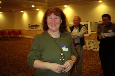
| woodlands redevelopment, public workshop- 2002 |
government team
i think part of the discussion - this part of it which is the natural versus the urban - part of it is when you
talk about community design - its getting people out of their cars and giving them the opportunity to go along the
pathway to get to their local grocer and to get to their ---- and without going in a car - and to do that you want
to provide amenities which are - you know - walkways and parks and stuff - but some of this stuff - but some of
this stuff needs to be all out commercial
people
okay - lets bring that one up - what kind of deal has already been done with iga or was it - ah - the save on
government team
03-18-35 - there was this idea to provide a kind of a - its called village heart and the idea is to - that the only
way to get people out of their cars is to provide shopping and other domestic services within walking distance -
its not a future shop location
people
so a coffeeshop ----
government team
it could be all these things but the local commercial plays into this idea - it gets people out of their cars
people
the key there is when its affordable - there are more than 3000 people on the site
people
and dont forget that fraserview is going to use it too - right now fraserview is a long ways away from any kind
of shopping - thats one thing i really hope they put on
government team
we did this a few sessions ago when someone from the group - but not me - ah - actually summarized what we said
in a way that sort of tells the other groups what we discussed in sort of a --
people
03-19-45 - well you talked most of the time
laughter
people
number 3 - we havent really discussed -
people
access to other stuff - i mean making it a livable area
people
what about gardens around these benches that we can sit around - are we - well just the opportunity to do your own
planting to get you own shrubs included and stuff like that -
people
well if you are buying the house the chances are youll have a piece of property - you are interested in one of those
townhouse properties right
people
well do you have a community garden
people
in west vancouver you have gardening guidelines - you cant make changes - do dramatic things to your garden without
the citys approval so you dont have somebody planting trees in their little plot of green which - that will shade
another yard - you agree to this when you buy into that property
government team
there is always the possibility if you are part of our rental unit to make a strata agreement to share a community
garden - and there is also the greenhouse which we have proposed could be part of the property
government team
we are just going to come back into a large group for 10 minutes so that each of us can hear a report about what
all the groups talked about and then we will take a short break and we are going to come back and were going to
hear from - were going to talk about some traffic stuff
government team
okay - we will start at this end - just quickly give us a rundown
people
question one - what specific elements in green space and open space most contribute to a viable community - we basically
have five - a sense of openness - greenways should be functional - in other words they need to feel that theyd go
somewhere as opposed to being for the sake of of being - 03-21-05 - pathways and bikeways that are separate from
the roadways so that we are not saying that okay we have a roadway and two sidewalks and that makes it a people
way - but at the same time the roadway should accommodate walkers and bikes and public spaces should feel public
- in other words they should be able to feel inviting as opposed to having public space that you dont know whether
its public or private cause you are a little unsure because of the layout - question two - looking at the opportunities
and the strengths and the challenges - separation of the private from public space - you dont want that apartment
house surrounded by a freeway - so we see that as being one of the challenge - ah - also - the heritage trees and
buildings on the site have to be preserved - how do you create these walkways so that we can take advantage of the
heritage trees and buildings that are there - and striking a balance between respecting the privacy of adjacent
communities - things like jameson court - the hospital and the actual community itself of woodlands and at the same
time not making it isolation - we see this as a challenge and also one of the things is we also see woodlands as
being a cornerstone for being able to connect into external greenwasy both at the river - we have got queens park
we have got the ravine - that really we saw as being a cornerstone - thats an opportunity that woodlands could really
capitalize on - question 3 - some of the ideas that we find appealing - variety in contrast between the two main
greenways - the north south and the east west - we see security as being important - keeping areas open visually
in order that we can use the community to provide its own security - 03-25-05 - covered seating areas - this is
something we would like to see - um-- and that was traditionally on the present site - small scale commercial activity
we also deemed as being important - having those green ways to accentuate that - and definitely we saw it as being
pedestrian oriented as opposed to a car oriented open space in woodlands and as well services and paths need to
be very bike oriented - gravel is wonderful to go walking but not great for bikes
applause
second group
people
i guess it is interesting - our first comment - the first comment received was that more green space means that
there needs to be higher density - in other words the density goes up instead of out - and there was some concern
about that - in terms of density and in terms of green space and then we got into what we thought would be the positive
elements of the green space - eyes on the green space - safety feature - so that peoples windows were arranged to
overlook - we talked about connections to sapperton landing - seems to be quite poor at this time and we would like
to see this improved a bit - trees - we did want to see them protected and additional plantings - we all got into
talking about the leaf problem that happens with - well i guess every kind of tree - but i guess there are different
- and in terms of that a little bit about allergen producing trees - we like to see a range and gardens both the
allotment gardens - the public gardens - and the private gardens - whatever we really like to see in our green space
- ah - opportunities and constraints - ah - we did like the idea of containing and enhancing the green space along
columbia - improvement of some of the walkways in that area - 03-27-50 - the cycling linkage -thats the word - oh
yeah we really wanted to see the cycling linkage - ah - on that side of the city and we saw that as a real opportunity
that the woodlands site gave us because currently any cycling in that area is not very pleasant - ah - we talked
about the underground streams and the water that flows in that area and that that could be a constraint - ah - then
we got into a little bit more about the linkages and we were really excited about the fact that with an overpass
to queens park - some better linkage to sapperton landing - perhaps a linkage to patullo bridge - and there is already
in the design something to the glenbrook ravine - ah - so it looks really quite exciting - the design ideas - ah
- kind of brainstorming - like to see more open space and we like the idea of fountains and water on the site and
we took that one further - we thought of the amount of water that was already there - perhaps theres a possibility
of a stream as a natural feature rather than something that is built in - ah - and we talked about good child play
areas - we thought that that was important and we like the idea of the wildlife bird and animal corridors
government team
could you just elaborate on your comments on sappeprton - the connection to sapperton
people
- ah - as far as we could figure out the current connection into sapperton landing if you go all the way through
the site across - down the front of fraserview across at cumberland and back into ah - sapperton landing which is
actually entering at the far end of the - so we would really like to see something so that you could get over and
into it
government team
03-30-00 - i dont want to make any promises but i think in a meeting we were having with engineering the other day
they were talking about the new connection to sapperton were they not - we will pass that comment on to them
applause
third group
people
well lot of things have already been said of course - one of the things that we did talk about in the open spaces
is not to repeat what they do in queens park with big organized playgrounds but a place which is not just a look
at park - sort of thing - a place where people could throw a frisbee - things like that - im not going to go over
all of the things that everyone else has already gone over in that area so thats the only thing i picked up on that
we discussed that wasnt discussed - as far as the connections and things like that - what do you see as primary
opportunities and constraints - we also discussed the idea of getting from this area across to sapperton landing
and its good to hear that there is discussion on that - and - ah - you note the fabulous way we have laid our board
out here
people
were the post it note table
people
and - and - we also reiterated the idea that the people that are walking in a casual way - you dont want them to
be run over by bikes and at the same time you dont want the walking areas to be integrated with the roadways - obviously
people will use the roadways when they want to go somewhere - so essentially otherwise weve pretty much discussed
the same as everyone else - right
applause
government team
were right on schedule tonight which is very exciting so we have time for a 10 minute break so why doesnt everyone
just head over there - there is lots of good stuff to eat and drink - and we will meet back over here in 10 minutes
to hear from john steiner
break
government team
03-45-00 - okay im going to just quickly hand it over to john - hes going to quickly run us through his talk - about
10 minutes - then we can ask some questions - a little bit of discussion and then we can do some wrapup and then
richard bernstein from architectura is just going to close us out for the evening
government team
i am john steiner from urban systems - we do a lot of work - by way of background we have done a lot of work with
the city of new west in the areas of transportation planning - ah - we work on their city wide transportation plan
specifically in the areas of transit - bicycle facilities - pedestrian facilities - and a bit on their road network
links - we have done a lot of neighborhood traffic calming within the city of new westminster - so we do have a
bit of history here and just by way of going through this work there is a lot of - ah - i guess there is really
two categories of interest which i characterize - were looking at in the transportation system - we are looking
at - one has to do with the internal roads and the other has to do with more the broader context for new west in
terms of how this site fits in with the overall area in terms of transportation - so where we are at with each of
those is really on the internal systems - its very much interrelated with the process for the planning overall for
this site in terms of land use planning - landscape planning and so forth - but there have been some developments
in those areas in terms of overall design guidelines and ill talk very briefly about that and let larry talk a little
bit about that as well - in terms of external issues - and there are a lot of them - i think we need to go through
and where we are with that is we have identified with the assistance of the city of new west - some of the external
issues that they see as being very important for us to deal with in developing a transportation system for the site
- 03-47-10 - not only for cars but for transit - for pedestrians - for cyclists - and so they have identified a
number of issues and we have identified some potential strategies that we may pursue and i guess thats where we
really wanted your input - one - have we identified all these issues - and two - the general strategies on where
were going with this - is that where you think we should be going - do you have any other ideas - so i would like
to get some of that feedback - so what i will do is talk a little about what some of those external issues are -
the area surrounding the site itself is really surrounded by what the city and translink have referred to as the
major road networks - these are the major arterial roads designed to take traffic to and from new west and through
the new west area - most major roadways have been defined as columbia up to a point right at mcbride - 03-48-04
- going north and royal going east and west and so the idea of those and the city has made it absolutely clear that
they really want to make sure that we protect the overall vehicle mobility on those roads as much as possible and
that is a very high importance to them - the other issue which they have raised - and again some of these are obviously
external to what we can influence - but this is what we are dealing with and these are some of the issues we have
to respect as we go forward - the other issue which the city is very keen on and it kind of reinforces this role
of the major road network - is protecting columbia through the downtown area - the overall goal here is through
traffic calming and lane reductions is to to have this more - less as a through route and more as a local serving
route and they have been very clear on that goal - so there is a counsels direction on it - 03-49-05 - so that even
raises the importance of this - columbia - ah - mcbride and royal connection even higher - the other piece - and
there is a number of maps on the side here which i know you cant see butiI will just talk about them anyway - but
the other one is the truck routes - the main truck route that is adjacent to the site is mcbride - that connects
up with columbia over through to brunette pass the patullo and right north across 10th is the most northern truck
route in the city - so these are some of the external roadway issues that were dealing with and which we have to
incorporate as we look at connecting this site to the external system - so far and again this is in very preliminary
terms and if there are any other issues we will get at them in a little bit - but in preliminary terms what were
looking at - as was put up earlier - is an internal roadway network of which you would see possibly two connections
to mcbride - one at royal and the other one just south of the proposed memorial gardens - 03-50-11 - which will
be a new one - really the issue comes back to - for the city - is how these intersections may affect the overall
adjacent system in its mobility and congestion and so forth - what we are looking at here and again this is preliminary
direction - is that this will likely be a full access to the site itself - i forgot to mention blackberry to the
north - there will be no changes to that one - this would likely be a full access to the site which means you can
get in and out from all directions as you - as youre going up and down there on mcbride - were looking at different
options here with the city in terms of access to the site so it could be anything from a partial access where it
may be right in and right out - or it could be a full access using the existing connection with the existing signalized
intersection - 03-51-00 - but a number of issues that we have to deal with and it becomes as we go forward in our
evaluation - is how that might impact the operation of some of that road networ - so these are fairly important
issues and really thats the direction we are taking in terms of the roadway network to major system that would take
you off the site and to the site - the other issue and i will kind of go through this and later on we can reflect
back on some of these external issues - whether we have captured them all - whether you think there are strategyies
we are overlooking - the other issue is this notion of the bicycle network and larry referred to some goals in terms
of the on site facilities but the other part - and the city has identified and prepared a multiuse trail plan we
were involved in preparing an on street bicycle plan and essentially just so you know - again the external environment
were dealing with here is that in this lower map here it shows - and i realize you cant see it - it shows a number
of on street bicycle routes - 03-52-10 - and i guess were looking at how this site can facilitate connections to
this external area - the primary ones are fourth avenue west of queens park - it turns into an east west route which
is really in closse proximity to the pathway going through the site - whoever referred to the importance of the
material in terms of that bicycle connection through the site - it will be very important as we recognize that this
is part of a city wide system - it is not just a site facility for getting to and fro across the site - the other
ones are some of the routes on the east side of the site referred to as the crosstown route which is essentially
richmond - taking you along richmond then north going right into burnaby - the other route is called the cumberland
route which takes you north of - north of 10th into burnaby - so these are some of the external connections and
you can see how that in terms of external site planning - 03-53-03 - how that fits in with the overall system for
the city itself which would be of great importance - a high priority - this is the plan - im not saying all of those
facilities are there today so its important that we integrate this site as much as possible - ah - in terms of pedestrian
issues and again externally there is really - what it boils down to there - is a number of pedestrian connections
of interest around the site - obviously as we talked about earlier - quenns park - ah - pedestrian connections -
good pedestrian connections from the site along royal avenue as well as even getting down to the downtown area -
you know along columbia - and as it was referred to earlier the mention of getting over to sapperton and down through
there - so these are some of the issues we have to deal with in terms of connecting that on site facility with the
off site area in terms of - over all thats - the city has placed a pretty high priority on ensuring pedestrian accessibility
and safety and one of the concerns that have been raised fairly clearly in the previous workshops is the notion
of mcbride as being the barrier and i think larry referred to the possibility of looking at grade separation across
mcbride to overcome that barrier both for cyclists and pedestrians - so even though there may be an at grade intersection
- that seems to be possibility and probably an important facility to consider - the last issue and not least is
transit service and i think both for this site and the city transit service seems to be an important issue in terms
of access both skytrain as well as bus service - i should qualify first that overall the level of development within
this site wont necessitate or wont warrant an additional skytrain station unless theres some other plan the city
is looking at - but generally speaking it is not in that order of magnitude - the city is working with translink
on what they are referring to as an area transit plan for the burnaby new west area and currently there are services
running around mcbride and around - up 10th i believe - and around and down - up mcbride and back on royal - its
a big looping service today - 03-55-50 - the concepts that they are looking at in the area of transit is essentially
not that much different in terms of routing itself - what they are looking at are some improved frequencies of service
- they are looking at smaller busses but it still has that long looping route so some of the issues in terms of
connecting the site with transit - with that bus service - will be fairly important - some options we may want to
consider as a minimum - it reinforces the notion of good pedestrian connections at this location that connect up
with bus stops - so we have to think of where those bus stops might be located - again if you think of it on its
current alignment - not coming in the site on royal and mcbride and the fact is if you want to have access to both
service that goes up to the north as well as service - its a big loop - so service that is going back into - down
royal - the other option i would look at in this work is the possibility of bringing service into the site - the
vehicle theyre proposing to possibly use is the community shuttle - so its a mini bus service - it is reflective
of the level of demand over all on that particular route - 03-57-03 - it would be very much suitable to some of
the - what we will talk about - on site road conditions and circulations - so you might be able to bring into the
site that bus service - the other option is also providing two way service - looping services are generally quite
difficult - theyre not usually very successful but its reflective of the big challeng of getting around this area
- so two way service might be an option as well to consider - but certainly the notion of coming into this site
is an option we would want to explore with transit as well - again it is not bringing the big busses into the site
and thats important because the idea is not to necessarily make the roads the big 12 meter roadways - so it would
be very much conducive to the community shuttle service - ah - i will kind of throw it out to any question in terms
of the external issues as it relates to roads - transit - pedestrians - or cycling to get suggestions as to what
you see as some of the other issues we have overlooked or ideas that we might look at
 |
| woodlands redevelopment, public workshop- 2002 |
 |
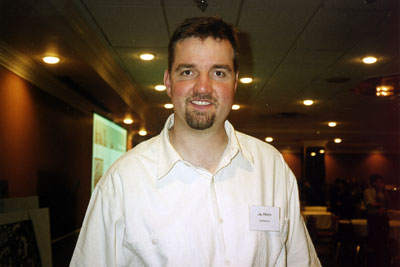
| Potential resident of the proposed new woodlands community-2002 |
people
03-58-21 - your connection to royal as far as i know wont work because when you drive up royal to the site you are
right at the nurses lodge and unless you are planning to relocate that you cant connect it directly - it would have
to be an indirect connection there - an offset
government team
yeah - the question is - or the reference which just might clarify this for everyone is if you take the road straight
through and you are looking down royal you can see what youre going to go into and that is a real issue that we
are looking at both conceptually and functionally in terms of where that roadway comes in and we will have to cut
fairly on a sharp curve going north in order to go around and not be stuck down - cause theres also the great change
there too - not just the fact that the buildings there could be very costly for fill - retaining walls and so forth
- thats the real issue - we think we can overcome that physically by redirecting that roadway as soon as it comes
into the site slightly to the north by a fairly long curve - so we may be able to overcome that
people
is the site connected right onto mcbride or is it after the turn off onto the bridge
people
this is the cemetery you are looking at - this part of the site and yeah where it links up to mcbride
government team
there is currently the access and egress to queens park were just south of there where that new access likely will
be - so its just south of the cemetery and the idea is that it would not connect up to this and i guess it - again
another external issue we need to be aware of is that the city has made it fairly clear 04-00-00 - and i know they
have gone back and forth in terms of opening and closing that access to the park - its preventing through traffic
in the park - they really dont want this to be an access road to the park - we are well away from that access point
- we wouldnt want torealign anything here and the fact is it could probably operate fairly well as a signalized
intersection without much impact on mcbride
people
im curious as to why it would have to be signalized - if we are dealing with a closed circuit here - a closed community
- right left turns are pretty simply made
government team
two issues i guess - one of them is if you want to go south on mcbride either down around into other parts of new
westminster - get onto the patullo - you would come off this exit - you would want to turn left on to mcbride -
that from just a pure operational point of view - that would be problematic
people
the volume there is incredible
people
were talking about mcbride - the main street - arent we
government team
yes
people
oh you are ---- seriously - 04-01-20 - then right before the bridge there would be a signal light for the major
traffic flow going over the bridge
people
one more - thats just asking for trouble i thought it was beyond the curve on that one way street as it exists there
government team
no the one way street is just this little bit here
people
holy christ - thats a huge impact - that is ----
people
yeah that would have to be very well done because it will not be appreciated by anyone going across the bridge
people
surrey people wont like it very much - thats for sure
people
thats great - two curves and an uphill and the light
people
04-02-00 - yeah if you were able to contain the entrance and the exit it would then - the bare area - without touching
mcbride it would be so much easier to get into that complex - when you access it to a major intersection i think
youre just asking for access problems
government team
as i was saying earlier in terms of - and i appreciate what youre saying in terms of basically the impact of that
on through traffic - the - what we have done and again we are still very much at the preliminary stage - we have
looked at these micro simulation models of the signals and how they would hit - they would basically be coordinated
between here and here - this is the real sensitive issue down here in terms of congestion - coordination of signals
- storage areas and so forth that we are really paying attention to - up here - and im not making light of this
at all - but certainly the operation of that - the amount of traffic that would be coming out of the site to go
- 04-03-00 - the amount of traffic coming out of the site is generally modest but the traffic coming out to do the
left turn is really just more for access -
 |
| new westminster resident and social activist- 2002 |
photograph
the issue here - and were looking at several options - partial access right to full access - i think that what we are really saying is that i think that there are a number of possibilities here but we will always have that one as a full access here and in and out
photograph
people
what with the simon fraser property thats been put aside you dont have a hell of a lot of choice here - that blue
section is cordoned off so you cant go through there with a road - if you had one entranc and its split of and created
a one way around and coming back you would only have to have one entrance
government team
04-04-02 - it was the other way around actually - that site was picked up because thats where the city would not
allow any sort of access - on the bend
people
so they prefer a light on mcbride
government team
they prefer that way - either end but not in the middle
laughter
people
i mean you get the steepest part of the grade at royal - we have all driven this road havent we - you put a stop
sign there - you have heavy trucks coming up and stopping on that grade - its going to be a nightmare
government team
at this one
people
no at royal
government team
there is an existing signal here and just to reiterate what i was saying earlier - the real issue is and again -
04-05-00 - i reiterate some of these assumptions - the city really wants to reinforce the major road network - mobility
- this notion of traffic making that movement in getting off from columbia - these are pretty important intersections
in terms of coordination - storage requirements and so on - it wont be an easy initiative - the city has even gone
so far as to say possibility to northbound left turn lanes to reduce the storage requirement here so the vehicle
queue doesnt go back onto columbia - so they are really serious about this initiative and are prepared to look at
different options - again this is outside the interest of the site but i think it just shows how prepared they are
people
is there any way to connect towards blackberry and possibly doing it that way
people
and possibly doing it that way around
government team
yeah its being connected in and its still going to remain as the existing roadway - its still going to remain a
right in right out - 04-06-05 - which means you can only go right in and right out
people
no i mean on the inside of the property - you dont have it connected to blackberry
government team
yeah we do - theres a roadway connecting through right at this point - it actually goes around here - so there is
a third way to access the site
people
then why do you have to build a second access
government team
it will remain as a right in right out
people
and they cant make improvements to that
government team
its pretty heavily traffic calmed in there - speed bumps and all - it wouldnt be a major access point just because
of the nature of the local context - 04-07-00 - again its really about access and circulation - having multiple
access and circulation - the site is quite a challenge - there is no access here - there is no access here - there
is a large housing units here so we are trying to make it convenient - any other issues which we should discuss
people
are you aware of a plan to create a bicycle link to the patullo bridge
government team
yes and in fact the current bicycle plan for the city has the connection of the west side of queens park going south
and connecting up with the patullo - there have been a number of initiatives lately of which we are currently working
on - the patullo bridge in terms of bicycle facilities - perhaps enhancing the safety of that - but the issue becomes
a connection too on the city streets - this connection is marginal for - ah - 04-08-04 - in terms of safety and
other issues that are still being dealt with but the city is - i think theyre going to invest in this connection
- translink is committed to investing in improvements - in investing in the bridge itself - ah - pending the outcome
of --- the ----
government team
yeah these are low cost - really reallocating some space - to be quite honest its not going to be capital intensive
- its about reallocating space on the bridge in order to make better use of the existing space - any other questions
people
im just trying to process the one off royal and the more you talk about it the more i realize it really is an issue
- there is a back up you know - the accesses are really big issues - the back up to get onto the patullo bridge
- to get off the patullo bridge - either direction is all funneled through mcbride and then royal complicates it
- if youre trying to take a turn off the bridge to go down to columbia - either direction and you can end up backing
up onto the bridge and you will at certain times of the day and even trying to get back during rush hour in the
evening if you are heading toward surrey - the traffic backs up and as a resident of surrey how do you get in there
- you get caught in that problem - but i dont know anyway around it
government team
i guess this is really a bit of a dilemma its - youre damned if you do and damned if you dont i dont mean that too
deeply but really providing an access here can in some ways help the situation cause you will still get traffic
turning left in here and taking away from that north south movement so from an access and signal coordination -
04-10-20 - there are benefits to having that - having people going right through the intersection rather than just
building up more turning movements - thats really what it boils down to - there is an issue here in terms of again
- its related to the site itself that the city has to deal with and that is coordination and congestion through
here - there are some scenarios in which having an access here wont take away necessarily that problem - it wont
solve the problem but it wont make it any worse by doing that - i guess thats that fine line youre dealing with
people
i cant help underline the fact that if people are using alternative modes of getting there and leaving there - if
its access by pedestrians or cycling or transit or what ever - thats just so much the better - those links are essential
government team
the residential streets - remember that in new westminster - handle 10000 cars and trucks per day
people
which means it should be successful with that kind of exposure and all im trying to say are that the implications
of that success - which is good - dont get me wrong - is further additional traffic in and out of that one entrance
- now you cant deter that - now you cant get out - if theres a block going onto royal and down to columbia - where
are they going to go guys - theyre going to go back through the neighborhood and try to come out the other way -
thats going to be blocked - where is that going to go next - i am going to go take a right off of blackberry drive
- you could conceivably end up with a traffic jam in the middle of a very quaint quiet neighborhood
government team
i dont know - in the traffic study - did you separate or can you identify the percentage of the volume of traffic
which is going through that intersection which would be commercial versus site generated residential
government team
yes and i dont have those numbers but thats really what youre getting at here - would be the access to this site
its really - even though there is the expectation that it would be pedestrian oriented and locally serving were
still looking at a fairly nominal level - relative to the site itself - and i guess i put it on relative scale at
this point in time rather than more specific - i dont know the specifics but relative to the site itself its fairly
normal - these are not big box types of developments - 04-13-35 - these are neighborhood type generating and dont
necessarily generate a lot of traffic - i appreciate its more - the issue here is more from an operational point
of view - its one of bringing them into the site far enough that anything that happens here - something is going
to occupy that site - some form of development is likely going to occupy that site - residential or otherwise -
that that traffic has to be cleared of this intersection before it starts turning into other access points - so
we have to be far up in the site - this is more of a design and layout issue so that people are out of the intersection
- i think regardless theres going to be traffic there - the difference between that being a commercial versus a
residential may be just in terms of direction - it might even be adding more to that peak direction - ah - at the
end of the day i dont want to - i dont know the specific numbers but i think just generally the main issue will
be as long as you get them into the site well away from the intersection and we dont drop access points right at
the intersection it gets a long way in terms of safety - congestion - and operation - i will leave it at that
government team
i think this has been a really terrific workshop - we have got a lot of very specific feedback around both the landscape
and the traffic issues - a lot of those specific ideas will find their way into the design guidelines so what you
have contributed is extremely useful - youve come up with some ideas which reaffirmed what the planning team has
been doing in terms of linkage so it tells us we are not totally off base here - that we are on the right track
in terms of linking the two major parks - trying to get the north south linkages - creating new linkages preserving
and enhancing the major open spaces that we do have - you have also said things which go beyond our site - things
like linking into the third major park - the new river park - 04-15-25 -and that that should happen sooner than
maybe it does - and some of those issues are more city wide issues and you can be an advocate with your council
to try and get those things - not all of that infrastructure can be laid onto this development - conceivably because
there is a goodies package that we are trying to do on the site in terms of open space - pedestrian overpasses -
and heritage and there is only so far that that will go
 |
| architect consultant- government team- 2002 |
people
we have built paths to a brick wall before
laughter
people
its called future development
government team
very good - the next workshop we really want to start coming forward with ideas about what is the housing we are
talking about - 04-16-00 - in terms of density - in terms of types - everything from row housing to townhouses -
3 and 4 storey apartments - to mid rise - even some highrises - and where are the most appropriate locations on
site for these uses - we want to look at things like shadow studies and view studies and talk further about - you
know - as larry started to mention about the open spaces and the hierarchy of open spaces - you know we have the
greenways and that infrastructure of open space created - now we are going to start to go into these individual
enclaves with their own open spaces that are private - semiprivate and public - and how does that find its way into
an architectural expression of form that makes some sense within that overall broader network - thats what we want
to start bringing to you over the next couple of workshops - some of our initial ideas about how the plans get massed
out in terms of building form and the ultimate guide in this is how do we create a balanced community of open space
- 04-16-35 - and built form that really works together and feels like a place that we would all want to live in
- so thats the goal for the next couple of workshops
people
the workshop number five that youre doing about the market housing and density - it would really be useful if we
could have some numbers with regards to that - so that we know - you threw some out today - that youre saying that
its 18 - 20 - 30 million dollars in revenue - 18 to 24 million dollars in costs - we know some of the buildings
are going to be one to 7 million dollars to fix up - well if we can have some sort of concept - a little more formal
concept of what bcbc expects to make - it will help us in the discussion on housing and density - is that a fair
question
government team
its a fair comment - we will certainly have a range of numbers on the range of housing density - obviously it will
depend on how we put the final thing together - we wont know until the end of the day how much revenue we have -
we dont have a number that we expect to make
government team
its not the only driver - revenue is one driver - revenue is one driver - its also related to livability - to overshadowing
and approvability and adjacency to the neighborhood - so you have got to throw that whole mix together
people
i understand that and certainly that is considered but we cant sit here and wish to have the whole thing as greenspace
- we know that is not possible
government team
04-19-00 - exactly
people
but we also know that you dont have to put full 24 storey apartment buildings there either - so there is a break
point where you still sell the property - or piece of property - that allows us to get everything we have asked
for as a community - give us a ballpark and it would just be easier
government team
its about finding balance - thats representing everything from revenue to livability
people
right - and you dont have a concept of numbers at this point - surely you must
government team
let me put it to you this way - the people i report to would not like me to come forward with a plan at the end
of the day which gives them negative dollars
people
and so we must know where we are starting from in terms of having negative versus positive
government team
it all depends where you start out from - does the site have value - you know ----
people
we know it does
government team
whats the value of it - is it the value somebody would pay for it now or is - i dont want to get into a debate over
this - im saying you cant pin that down
people
how can we have an opinion about density then ----
government team
thats our business decision and youll just have to live with it
people
well hold on a second - its your business decision and you will have to live with that - thats not a fair statement
either - its your decision but we have to live with it as a community
government team
it is not a carte blanche business decision - again its related to approvability and that goes right to the neighbourhood
- to city council - so everything gets tempered by that - as you say we cant put 24 storey towers all over the site
- you wont be seeing that
people
i agree - im asking a fair question here - im not asking for magic - 04-21-00 - im asking for just - there has to
be - you guys have been doing this for six years now - you have to know ----
government team
i cant tell you the numbers because its - people are going to be buying in here - people are going to be possibly
buying the sites from us and we are not going to declare that
people
youre not going to declare the numbers
government team
no - do you ask that of any other developer - how much money are you making on the sale
people
we are the tax payers for bcbc - ill have issue with that
 |
| woodlands re-development, public workshop- 2002 |
government team
well you may
people
i mean its a fair question - i would think that if we were going to evaluate the property --
government team
04-22-00 - no - we are evaluating the property - and all i can say is that we will be open with you on the revenues
- you can see what we are proposing and we can tell you what the end numbers are and we will tell you what some
of our costs are - we will tell you what the overpass is - you can make a judgment call on that one - but i cant
say what the numbers - we dont have the numbers - we will come up with a plan at the end of the day - it will be
costed - the amenities will be known - the cost of getting there will be known - but whether its 4 million or six
or eight or 10 - at the end of the day who makes that decision of whether that is good or bad - thats not a question
for me or for you - its what it is
people
well its to break even is what you are shooting at - or is it ----
government team
04-22-40 - absolutely not - this government is not in a break even mood
people
youre saying that the direction from the government is to make as much profit as possible
government team
the direction from the government is to come up with a community use for the site
government team
great - and you guys know if you want to continue this conversation ----
people
ive got my answer -i - i - thats fine
government team
okay so well see everyone in two weeks - goodnight